



武蔵野市の「防災情報マップ」「浸水ハザードマップ」を確認しましょう Please check Musashino City’s “Disaster Prevention Information Map” and “Inundation Hazard Map”
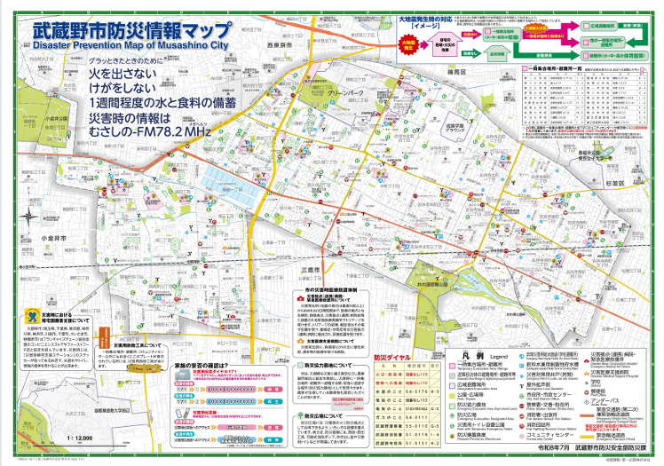
「防災情報マップ」は、地震がおきた時の対応や避難場所などの情報があります。防災公園、災害用トイレがある場所、防災備蓄倉庫などの情報もあります。
The “Disaster Prevention Information Map” provides information on what to do in the event of an earthquake and where to evacuate. It also includes details on disaster-preparedness parks, locations of emergency toilets, and disaster supply storage warehouses.
「浸水ハザードマップ」は、大雨による浸水リスクがあるエリアを示した地図です。台風などの風水害がおきた時の注意点やとるべき行動、警戒レベルなどの情報があります。
The “Inundation hazard map” shows areas at risk of flooding due to heavy rainfall. It provides information such as points to note, actions to take, and alert levels in the event of wind and water disasters, such as typhoons.
これらのマップは、武蔵野市役所、各市政センターで配布されています。武蔵野市ホームページでも見ることができます。マップを活用し、自宅や周りの安全を確認し、災害がおきた時に適切な行動をとれるようにしましょう。
These maps are available at Musashino City Hall and the various municipal service centers. They can also be viewed on the Musashino City website.Use the map to check the safety of your home and the surrounding area so that you can take appropriate action in the event of a disaster.
武蔵野市防災情報マップ(日本語)(武蔵野市役所ホームぺージ)
武蔵野市浸水ハザードマップ(日本語)(武蔵野市役所ホームぺージ)
〒180-0022東京都武蔵野市境2-14-1スイング9F
TEL 0422-36-4511 FAX 0422-36-4513
E-mail: mia@coral.ocn.ne.jp
開館日:火曜日~土曜日 9:00-17:00(日・月・祝日休み)